Bay Bits are part of OLO: Outdoor Learning Online. These short lessons are designed to give you a better understanding of our San Francisco Bay ecosystem and connect you to the natural world.
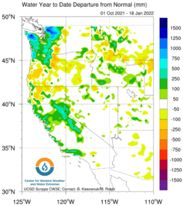
During the first three months of our water year (Oct. 2021-Sept. 2022) the Bay Area has enjoyed anywhere from 2 to 20 inches more rain than the average for this time of year.
Our advantageous head start this year can be attributed to a weather phenomenon known as atmospheric rivers, also referred to in pop culture as the Pineapple Express. Along with bomb cyclones and tropical storms, atmospheric rivers have been in the news more over the last five years as intensifying weather events affect more of the public.
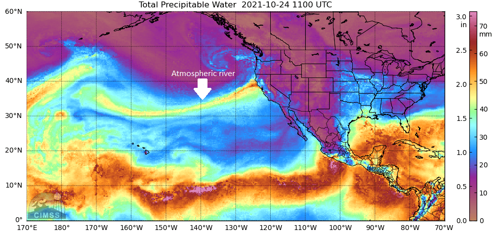
Yet, despite the recent uptick in reporting, atmospheric rivers have been an important part of California’s climate for thousands of years. As warm air rises it creates low air pressure at Earth’s surface. Surrounding air rushes in to fill the low pressure space and spins counterclockwise due to the rotation of the Earth. The orange-purple swirl in the figure below over the northwestern Pacific Ocean is an example of this low pressure system. As the air moves, it creates a current near the surface of the Earth that pulls hot, wet air from the tropics (seen below as bright blue/teal) towards the continent. The low ‘river’ of atmospheric water hits our coastal and Sierra mountain ranges and is driven upwards, releasing its moisture as rain or snow.
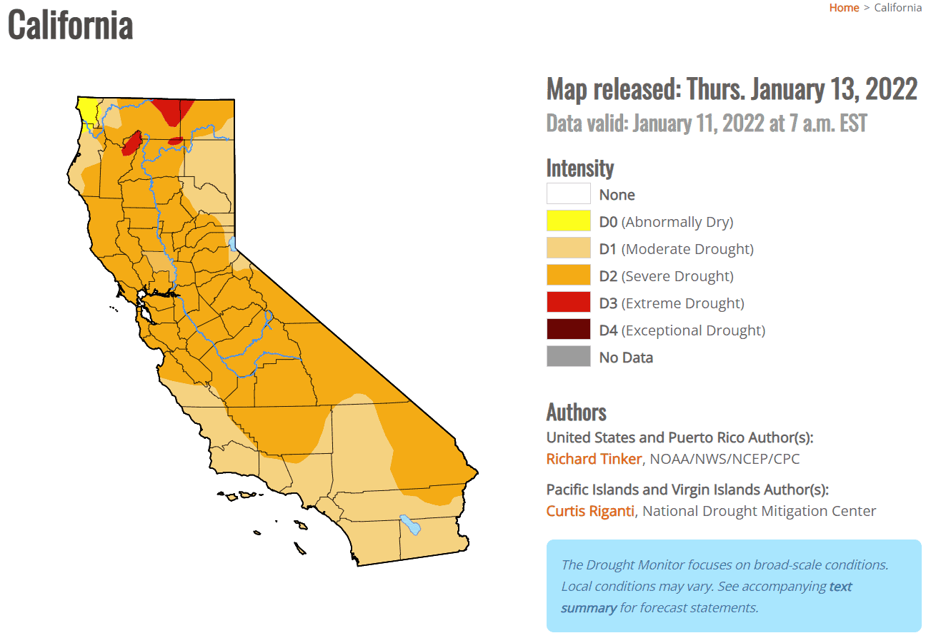
These hefty vapor streams have a flow similar to the Mississippi River at 500,000 ft³/s. That’s close to 6 Olympic swimming pools per second and 25 times the average flow of the Sacramento River. Despite the two atmospheric rivers we’ve had, all of California is still experiencing drought conditions, severely in some regions.
Studies have shown that as the climate warms, atmospheric rivers also become warmer, especially in the winter months. This results in less snowpack and more rain. This has huge implications for water management in California. Managing the slow release of snowmelt is easier than the amounts of rain that atmospheric rivers dump in a week. Tidal marsh restoration, naturalization of waterways, and urban greening are vital in mitigating flood damage and retaining the atmospheric river water that, studies show, will be more intense and interspersed with extreme drought in the years to come. Weather patterns over the world are changing in step with our warming climate. We must plan and adapt for a changing climate, which includes atmospheric rivers, that will likely bring more rain than snow. This is why Save The Bay assisted with the recent release of the Resilience Playbook, which offers a roadmap to equitable land use policies to guide sea level rise (and other climate adaptation efforts) planning around the Bay Area.