San José communities are already feeling the effects of climate change, with historically under-invested neighborhoods like East San José facing the first and worst impacts. Last December, Save The Bay conducted an outreach workshop with Latinos United for a New America (LUNA) to gather feedback on the climate impacts being faced by community members and explore possible solutions.
Urban heat islands1 came up as one of the main concerns, with multiple community members sharing that summer heat and lack of shade prevents them from even taking a walk in their neighborhoods. Local parks offer little relief, with playgrounds and benches rendered unusable by the heat. Nature-based solutions like urban greening can help build East San José communities’ resilience against this and other climate impacts. Replacing impermeable paved surfaces with permeable green alternatives reduces urban heat, protects homes and infrastructure from flooding, and filters stormwater before it reaches the Bay. Read on to learn what East San José residents had to say about urban greening in their neighborhoods.
Community Outreach at Veggielution’s Farm Stand
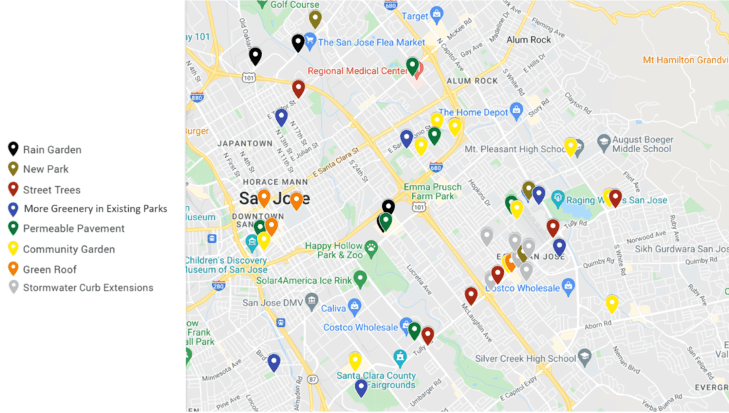
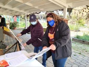
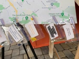
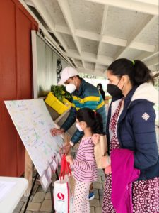
On February 26th, 2022, Save The Bay tabled at Veggielution’s community farm stand in East San José. Alongside a Spanish interpreter from Plastic Free Future, we spoke with community members about urban greening and the kinds of green spaces they’d like to see in their neighborhoods. We also invited folks to suggest locations for urban greening in East San José by placing colored pushpins corresponding to different types of urban green infrastructure onto a map of the region.
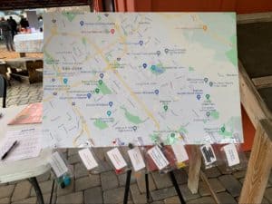
A map of East San José, with colored pushpins corresponding to different types of urban green infrastructure. Photo Credit: Dennis Uyat, Plastic Free Future
The resulting map was a rainbow of suggestions, reflecting the same widespread community support for urban greening that we saw at our virtual workshop. Community gardens stood out as the most popular form of greening, receiving 11 of the 47 total suggestions. Community members were also interested in other greening strategies like street trees and adding more greenery to existing parks, as well as stormwater-focused strategies like permeable pavement and stormwater curb extensions.
Community Feedback Highlights the Need for Equitable, Multi-Benefit Urban Greening in East San José
The urban greening projects suggested in this map would help correct for the historical deficit of green spaces in East San José. Data from the city’s Department of Transportation2 shows that East San José has a lower concentration of high-benefit trees3 than other parts of the city. This leaves the region vulnerable to urban heat island effects, underscoring the need for shade from a tree canopy. East San José is also home to a number of exposed creeks,4 leaving surrounding neighborhoods at risk of flooding as climate change causes water levels to rise. Locating urban greening in these areas can help mitigate the effects of flooding, absorbing excess stormwater and directing it away from homes and infrastructure. Interestingly, the community suggestions in this map also overlap significantly with the City of San José’s Tully Road Vision Zero Safety Project. This presents the opportunity to incorporate urban green infrastructure into the existing project. Greening elements such as stormwater curb extensions will calm traffic, helping to meet Vision Zero safety goals while preventing flooding and filtering stormwater before it drains into the Bay. The Tully Road Vision Zero Project also provides an opportunity to integrate urban greening with active transportation. As Tully Road is a protected bike lane per San José’s Better Bike Plan,5 adding urban green infrastructure will make the road safer, cooler, and more appealing for cyclists. Redesigning Tully Road will be a significant investment; San José can make the most of this opportunity by incorporating green elements at the beginning of this Safety Project.
Where in San José Should Urban Greening Be Located?
While the Veggielution tabling event is behind us, we are continuing to gather feedback on potential locations for urban green infrastructure in San José. If you are a San José resident, let us know where you’d like to see urban greening by filling out this form:
[1] Per the US EPA, urban heat islands are “urban areas where infrastructure such as buildings and roads is highly concentrated and greenery is limited, which become ‘islands’ of higher temperatures relative to outlying areas.” Find more information about them here: https://www.epa.gov/heatislands [2] https://csj.maps.arcgis.com/apps/webappviewer/index.html?id=ed73399ee4e94ceb9d1c55cb7802bdc7 [3] Per the City of San Jose’s website, high-benefit trees are living street trees within the City of San Jose’s Right of Way [whose] structural value, carbon sequestration, and pollution removal capacity is valued at $20 per year or more. [4] https://csj.maps.arcgis.com/apps/webappviewer/index.html?appid=becf9448882e4158aa742c065d8342f1 [5] https://csj.maps.arcgis.com/apps/webappviewer/index.html?id=f5f8d005271c4300ba3f99cb90abb246