With the recent rains and the atmospheric rivers, Bay Area residents are all too familiar with the flood risk facing the region. Highways were shut down, schools were closed, and homes were flooded. Currently, approximately 355,000 residents and $46.2 billion worth of property in the Bay Area are at risk during a 100-year storm (defined as a storm with a 1% chance of happening in a given year under current conditions). The risks of flooding from sea level rise, groundwater rise, and rain are only expected to increase as climate change intensifies.
Sea Level Rise
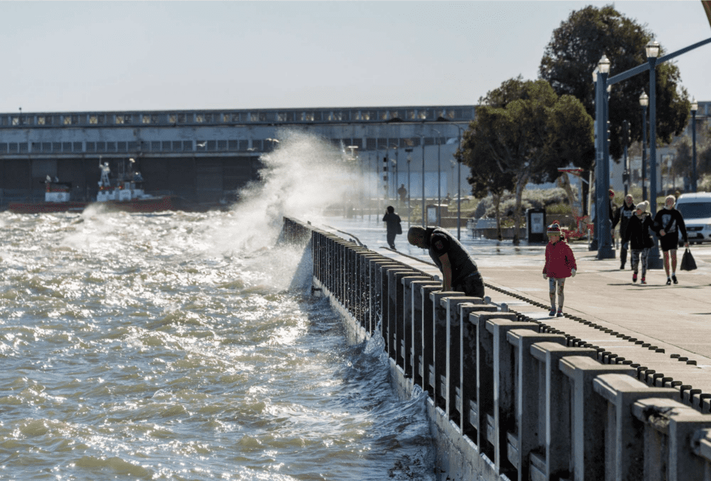
Melting ice caps and thermal expansion of sea water due to climate change cause sea level rise. Sea levels in the Bay Area are projected to rise up to 1.9 feet by 2050 and up to 6.9 feet by 2100. Though sea levels are currently rising slowly, they are expected to speed up around 2040, making it critical to invest in shoreline protections such as levees and restored wetlands as soon as possible.
At risk of flooding from 4 feet of water rise* |
||||
|---|---|---|---|---|
| 28,000 socially vulnerable residents** |
1,900 residents living near contaminated sites |
5 million daily highway vehicle trips |
60,000 daily rail commuters |
20,000 acres of wetlands |
| *Impacts from flooding that could occur at 48” Total Water Level from the ART Bay Area Regional Sea Level Rise Vulnerability and Adaptation Study. Total Water Level includes impact from temporary storm surges as well as permanent sea level rise. **Socially vulnerable residents include residents who are low-income, non-English speakers, non-white, disabled, elderly, or do not hold college degrees. |
||||
The map below, created by Our Coast, Our Future, shows which locations in the Bay Area will experience coastal flooding under various sea level rise and storm scenarios.
Groundwater Rise
Another source of flooding due to climate change, which has only recently begun to be better understood, is groundwater rise. Just as melting ice caps and warmer waters cause sea levels to rise, they also cause groundwater to rise in areas where groundwater aquifers are connected to the ocean. When groundwater levels rise above ground, they can cause homes and streets to flood, overwhelm aging sewer and stormwater pipes, and displace toxic contamination. California must conduct studies to better understand where groundwater rise will be a risk and prioritize upgrading stormwater infrastructure and cleaning up pollution in areas of highest risk.
A study released in 2022 by the San Francisco Estuary Institute mapped out the current and future risk of groundwater flooding along the coasts of San Francisco, San Mateo, Alameda, and Marin counties.
Inland Flooding
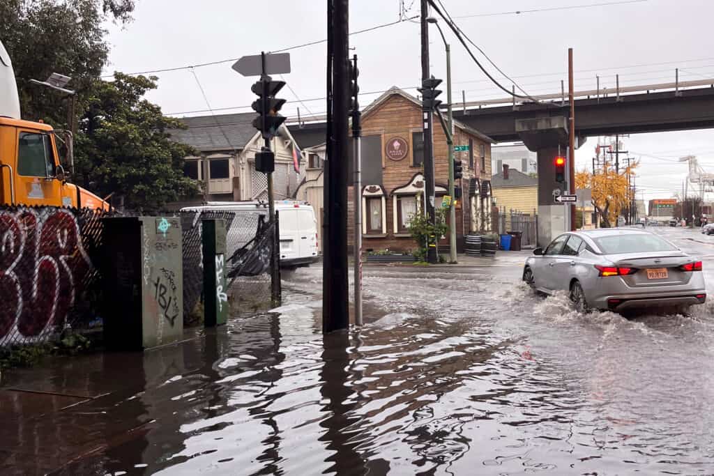
Flooding is not just a coastal issue. During heavy rains, flooding may also occur inland in areas where drainage is poor or creeks and rivers overflow. While these flood risk spots are not as well mapped, we know that recent atmospheric river storms caused flooded homes and streets throughout the Bay Area. Additionally, you can view the real-time status of flood gauges on creeks and rivers on the National Weather Service’s site.
As climate change advances, the Bay Area will experience more intense storms which will continue to lead to localized flooding unless we can upgrade our infrastructure in time. Improved stormwater infrastructure – such as rain gardens, bioswales, retention basins, and upgraded drains and pipes — would ensure that when it rains, the water is efficiently channeled away from streets and buildings.
A Collaborative Solution
Addressing the threat of rising sea levels and intensifying storms will require coordination between cities, counties, state agencies, and state and federal elected officials that has so far been lacking. For instance, cities should be required to create and implement plans to build shoreline resiliency, improve stormwater infrastructure, and reduce development in flood prone areas. However, they currently lack the necessary funding and legal obligation from the state to do so effectively. Additionally, it’s crucial that cities and counties coordinate with each other in creating regional sea level rise plans so that flood infrastructure in one city does not increase flood risk in another.
Stay tuned for more information about how Save The Bay will be working to bring these many pieces together to ensure that the Bay Area is ready to face the growing threat of flooding.