The Bay Area is home to a vast number of hiking trails, each one with a unique terrain and surrounding habitat. Whether you are interested in taking a short walk to a picnic area or mountain biking through woodland terrain, you can find what you are looking for around the Bay. Below are just a few of our personal favorite sites to explore in the place we call home.
Alviso to Newark
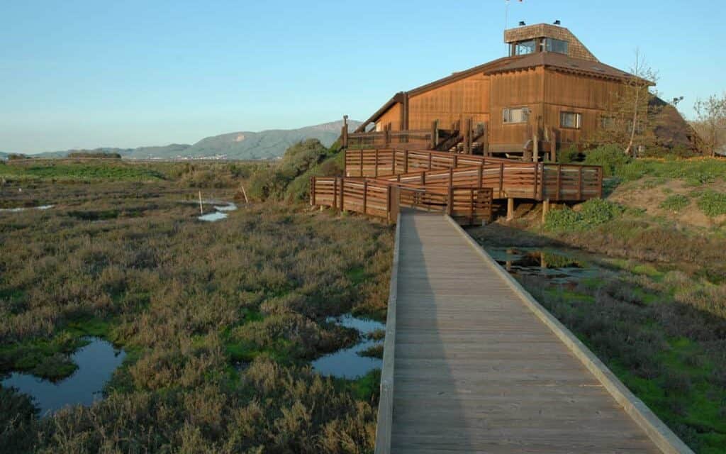
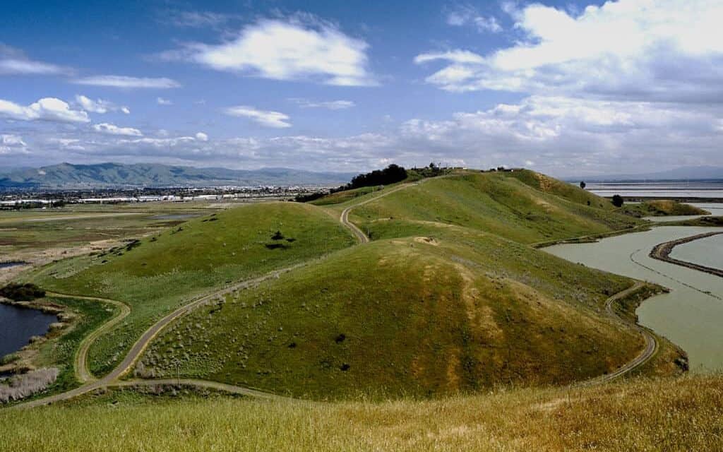
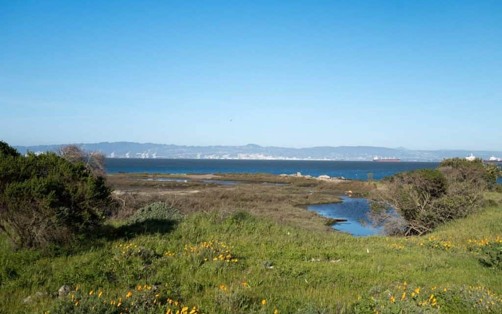
Alviso is a waterfront town in the city of San José, located at the southernmost part of the Bay. The former marina has been restored back into wetlands and houses a variety of trails. As you explore you can see wetlands, brackish and freshwater marshes, and salt ponds. The nearby Environmental Education Center off of Grand Boulevard exhibits some interpretative displays of wetland wildlife and has its own 4.5 mile loop trail surrounding a restored salt pond.
Burlingame to Redwood Shores
This 15.2 mile trail begins at Anza Lagoon and hugs the shoreline until you reach San Mateo’s Ryder and Seal Point Parks. These parks feature playgrounds, picnic areas, and restored wetlands where you can launch kayaks, enjoy lunch, and observe the tidal water system. The trail continues further south to Belmont Slough where enthusiasts can continue to Redwood Shores Ecological Reserve for an even longer hike.
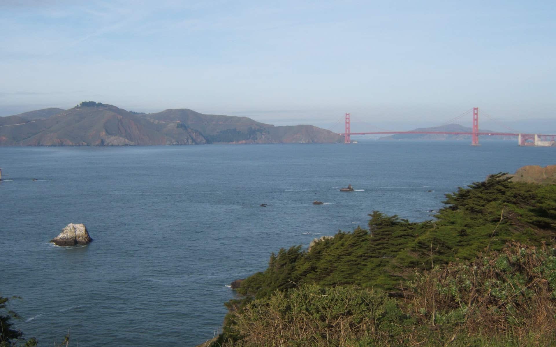
Corte Madera, Tiburon & Strawberry
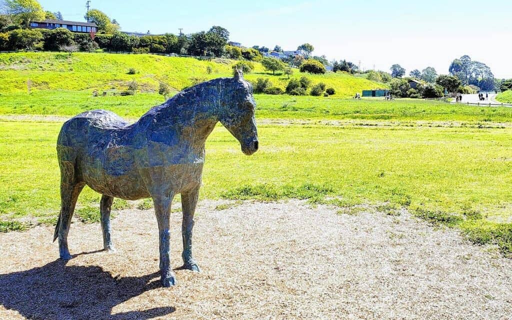
For this trail, bikers can travel south down the Tiburon Peninsula on Paradise Drive for beautiful views of the Bay. Hikers can begin in downtown Tiburon and walk along an old railroad alignment for around 3 miles before reaching Blackie’s Pasture where you can visit the statue of Blackie the horse. For more of an adventure, head to Strawberry Point and hike the Shoreline Spur Trail for even more bayshore views.
As an extra side trip, catch a ferry from downtown Tiburon to Angel Island where you can hike around the island or have a picnic lunch.
Hudeman Slough to Black Point
Though this portion of the Bay Trail is not fully complete, there are four segments open to explore the marsh plain, sloughs, and mudflats of the northern San Pablo Bay: the Tubbs Island Trail, Sears Point Bay Trail, Sonoma Baylands Bay Trail, and the Port Sonoma Marina Trail. Note that the Tubbs Island Trail can only be accessed from the eastbound direction on Highway 37 and does not allow dogs.
Newark to San Leandro
This 12 mile walking and biking trail begins at the Don Edwards San Francisco Bay National Wildlife Refuge Headquarters and ends at the Hayward Shoreline Interpretive Center. Along the way you will find Coyote Hills Regional Park and a Visitor Center filled with wildlife and wetland display exhibits. Pass by Eden Landing Ecological Reserve where you can find fishing ponds and picnic sites.
Northern San Rafael Shoreline
The area of Northern San Rafael contains a plethora of flourishing trails and parks to explore on foot or bicycle. San Rafael’s Las Gallinas Valley Sanitary District is home to 3.5 miles of trails that yearly welcome more than 185 different bird species. Once you are finished exploring there, head down to China Camp State Park – a beautiful and large woodland area near the water perfect for hiking (or even mountain biking) which includes a museum documenting the history of the area. China Camp State Park’s trail ends where a mile-long beach is located. McNears Beach County Park is the perfect beach for kayaking and canoeing, or sun bathing on sunny days.
Oakland to Albany
Begin this 15.3 mile trail at the Port of Oakland and visit Portview Park and Middle Harbor Shoreline Park for views of the Bay Bridge and San Francisco skyline. Head north and pass through the Emeryville City Marina and McLaughlin Eastshore State Park, named for Save The Bay co-founder Sylvia McLaughlin! The trail ends at the Albany Mudflats Ecological Reserve where you can find the Albany Bulb and beautiful bay views.
Ravenswood Slough to Alviso
This trail begins at Bedwell Bayfront Park, heading southward into the Don Edwards San Francisco Bay National Wildlife Refuge and finishing at Alviso Marina County Park. From here you can explore the Ravenswood Open Space Preserve, discover the Lucy Evans Baylands Nature Interpretive Center, and visit the nearby Sunnyvale Baylands Park which features seasonal wetlands and grassy uplands that are great for picnicking.
San Francisco Crosstown Trail
From Land’s End to the tip of Sunrise Point, this 17 mile trail traverses the entirety of San Francisco and includes a large range of terrains, perfect for both hikers and cyclists. You can explore beaches, community gardens, hidden parks, and breathtaking views of the city. Highlights of the trail include Visitacion Valley Greenway, Glen Canyon Park, and Golden Gate Park’s Stone Lake and Rose Garden.
San Francisco Crosstown Trail has provided a thorough resource to reference when you want to challenge yourself to complete the whole thing or explore one section. Click the link below to find a complete trail map that includes an app and a downloadable pdf to bring along with you on your journey – they even include bathroom breaks and public transportation!
San Francisco Southern Waterfront
Travel along San Francisco’s Southern Waterfront to take in sights new and old. Begin at Oracle Park and head south, passing by Agua Vista Park and the Chase Center. Visit Heron’s Head Park and India Basin Shoreline Park where you can step into Eco Center, the only 100% off-the-grid building in San Francisco. While Hunter’s Point Naval Shipyard is closed for redevelopment, take local roads to reach Candlestick Point State Recreation Area and Yosemite Slough.
San Leandro to Alameda
Walk or bike north along the shoreline of this East Bay treasure and view seasonal wetlands and mudflats lined with birds followed by Marina Park, an area with playgrounds, picnics, and a mile long trail out into the bay. Continuing north, Oyster Bay Regional Shoreline includes a steep upward walk that leads to a nice view of the bay below. About a mile above here is Martin Luther King Jr. Regional Shoreline, which houses Arrowhead Marsh – filled with pickleweed and salt grass. Further up San Leandro Bay you will come across the Tidewater Boating Center, where you can rent a boat or kayak. Keep going north and find yourself in Alameda bird watching at the Elsie Roemer Bird Sanctuary.
Your Support Matters
If you enjoy recreating along the Bay, support our fragile environment by contributing to the cause. Help keep our shorelines healthy and resilient by donating to Save The Bay.