The Bay Area has some of the most scenic highway drives in the country – with the Bay itself often the focal point. Over the past century, counties and the state transportation agency (Caltrans) built a network of major freeways right along the edge of the Bay. At the time of construction, this made sense as the Bay’s shoreline was not crowded, relatively flat, and provided the most direct routes in most cases. As time has passed, this aging highway network is facing daunting challenges: More car traffic causes congestion and long delays and, increasingly, these highways also face the risk of flooding from sea level rise because of their location near the shoreline.
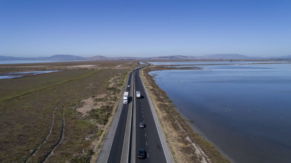
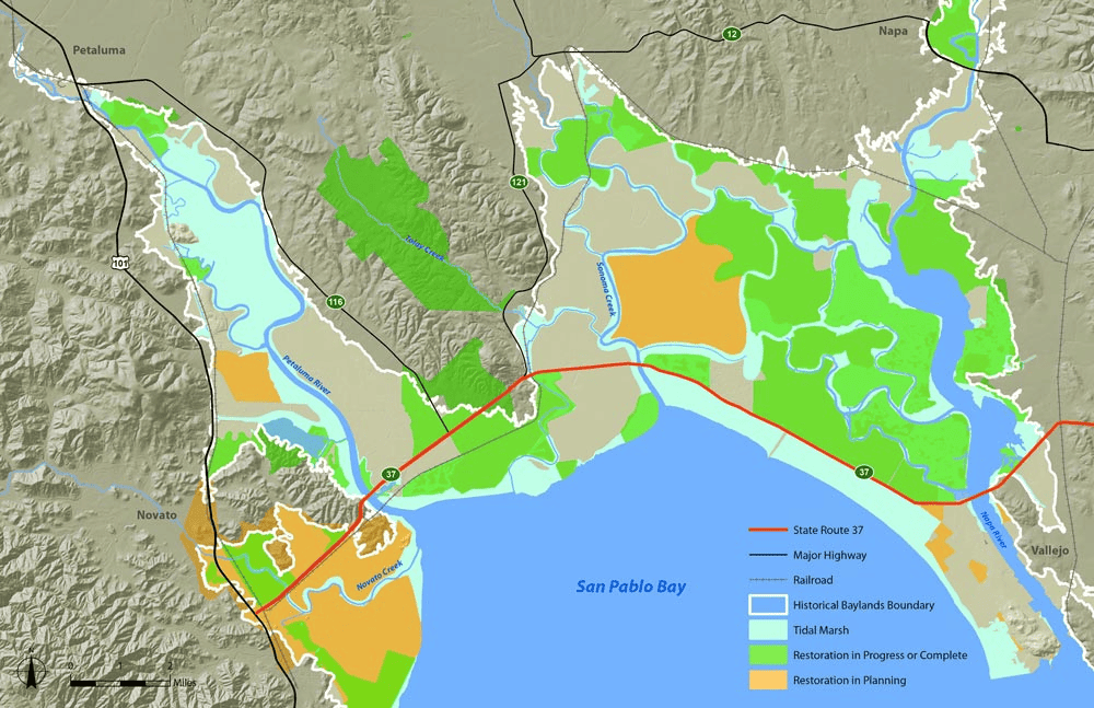
State Route 37 (SR37) in the North Bay is a great example of these issues and offers an opportunity to embrace a new model for resilient infrastructure that meets our modern needs. The highway was built along the edge of the Sonoma Baylands in an area that now includes the San Pablo Bay National Wildlife Refuge. The road now acts as a wall and cuts off tens of thousands of acres of former tidal marshes from the rest of the Bay.
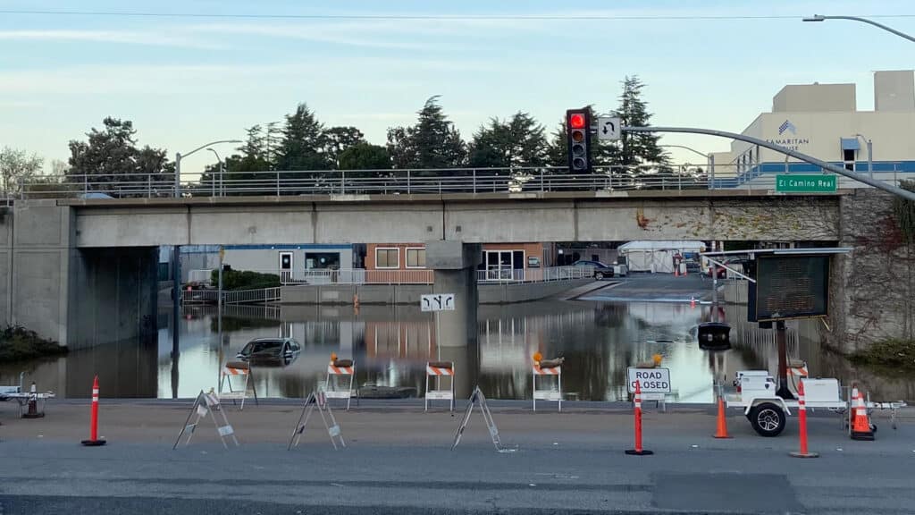
Also, the highway’s location just above sea level makes the roadway more vulnerable to frequent flooding during high tides and storms. As sea levels rise, the amount of time that the road will be closed due to flooding is projected to increase significantly. These closures prevent people from commuting to work, create delays in emergency response times, and cost the region a lot of lost revenue.
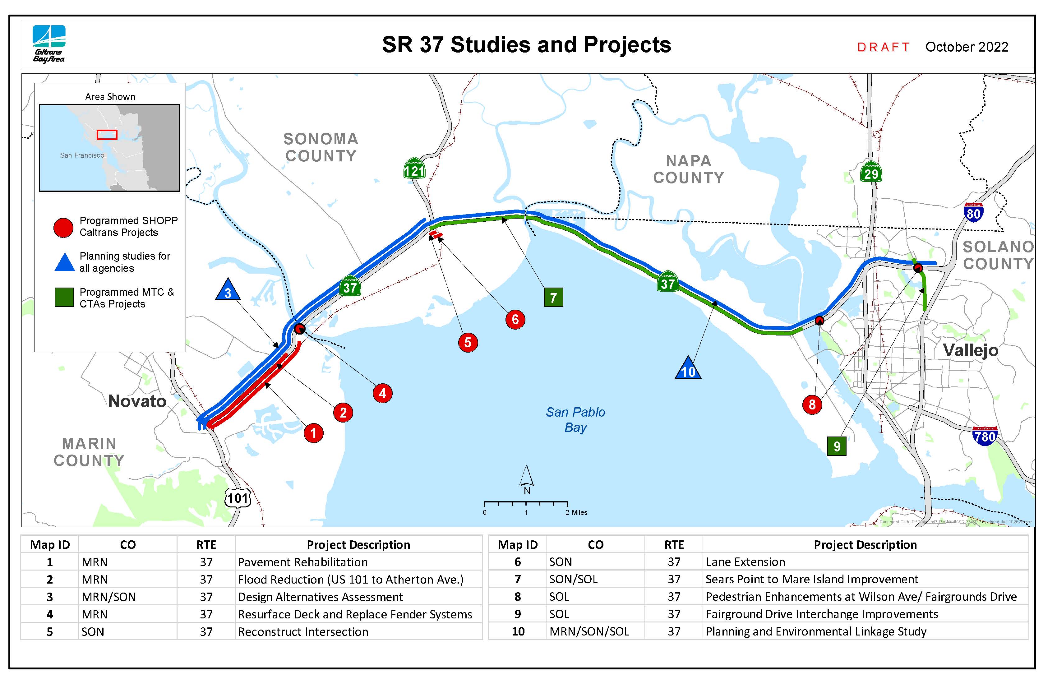
Plus, it’s a traffic nightmare. Anyone who regularly commutes between Vallejo and Marin County knows how long the delays can be. That’s why Caltrans and local transportation agencies have been working for years to design an upgrade to this critical corridor, but their plans to make basic upgrades to the road design have so far been stuck in the past.
A Bandaid “Fix”
To alleviate the traffic problems along SR37, Caltrans is relying on an old playbook by proposing to simply widen the existing highway between Vallejo and Sears Point. But doing that does little to solve the traffic problem and leaves the roadway at risk of increasing flooding as sea levels rise. Expectations are that this expanded SR37 will be heavily impacted by floodwater within 15 years. That’s not a very long lifespan on a highway project that is expected to cost more than half a billion dollars. What’s worse is that the project also doesn’t address the biggest cause of delays, which is a poorly planned and managed intersection at Sears Point that will continue to impact commuters.
This plan also ignores the impacts of the project on the San Pablo Bay National Wildlife Refuge, and the restoration potential for tens of thousands of acres of upland areas that could be returned to tidal habitat if the highway weren’t an obstacle. Restoring the Sonoma Baylands isn’t just important from a habitat health standpoint but also supports a major part of our regional strategy to project our communities from sea level rise using nature-based protections. That’s because tidal marshes can absorb rising sea levels and storm surges and buffer communities from flood risk by using the Bay’s own natural characteristics.
In fact, a joint study released in 2022 acknowledged all of this and identified an alternative design that would address the transportation concerns – travel times and flooding impacts – while also benefiting the Bay by allowing for the restoration a huge area of potential tidal marsh. This alternative would consist of a causeway that elevates the highway between Sears Point and Vallejo – similar to Highway 80 along the Yolo Bypass near Sacramento.
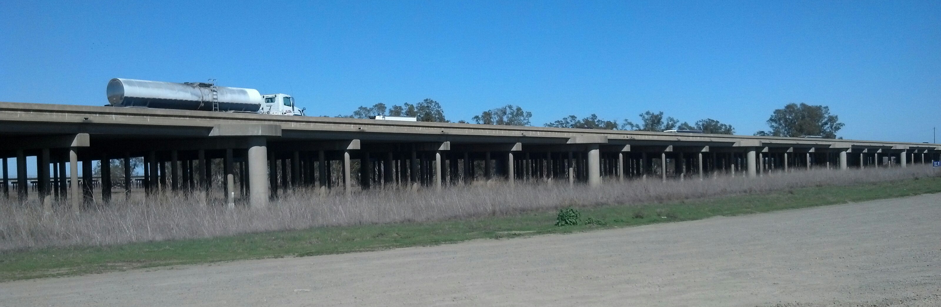
A causeway would allow tidal connections under the roadway to allow for upland habitat restoration and the rehabilitation of the Bay’s natural shoreline, while also ensuring that the road is resilient to flooding from current and future sea levels. And it would enable better transit access for Sonoma-Marin Rail Transit’s east-west train route.
Local advocates have been trying to get Caltrans to acknowledge the superiority of the causeway alternative for years, but Caltrans is focused on the short term while ignoring that the causeway is a better long-term investment. That’s because the current project is an expensive temporary bandaid – not a real solution.
A Longterm Solution – for Everyone and the Environment
A resilient SR37 that incorporates the causeway approach would be a model for transportation that is forward-looking and built for long-term flood resilience, while also incorporating real traffic reduction strategies like improved corridor planning and integration of “multi-modal” approaches that get people out of single-occupant vehicles.

Representative Jared Huffman has been a champion of the superior “causeway” design and has stated that Caltrans should embrace this as “a national model for resilient, multi-modal, multi-benefit transportation planning”. The alternative is a “wetland-filling freeway widening project straight from the 1980’s”. If we’re going to build for the future, we can’t rely on the approaches of the past.
North Bay commuters, particularly those who travel between Vallejo and Marin County every day, deserve a project that will actually reduce congestion and offer transit alternatives.
California taxpayers deserve to see that Caltrans is managing their transportation dollars effectively by investing in a project that is built once, and built right.
And the Bay deserves a project that will heal some of the damage of the past by reconnecting upland habitats to the Bay and allowing for the restoration of historic tidal marshes.
If we are going to build a resilient Bay Area, then we have to think differently and work to address multiple outcomes with individual projects. SR37 offers us a chance to do that, but only if Caltrans and other transportation planners are able to see the long-term value over the quicker build approach. Ultimately, building things right will pay off in the end.